
News
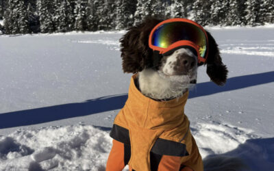
Expanding the Current Capabilities of Oil Detection Canines (ODCs) to Detect and Delineate Oils Submerged, Sunken, and Under Water and Under Floating Ice
This project investigated the capabilities of Oil Detection Canines (ODCs) to detect and delineate underwater (submerged and sunken) oil and oil under floating ice. A US-Canadian team conducted two highly successful field studies at the IISD-Experimental Lakes Area (ELA) in Ontario, Canada in 2024
Experimental Spills in Ice: Past Projects Informing Present Day Response Practices
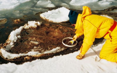
DF Dickins was selected for a grant award from the Prince William Sound Recovery Institute in March 2025 to publish the findings of groundbreaking historical research into oil behavior in ice. The objective is to review the results of fifteen experimental spills in ice conducted over a 50-year period…
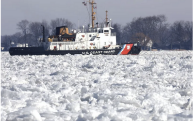
Guide For Oil Spill Response For Oil Under Freshwater Ice Conditions
This project is developing a freshwater oil in ice guide for U.S. Coast Guard (USCG) Federal On-Scene Coordinator Representatives (FOSCRs). The Guide will provide much needed and new information on best practices for responders in the Great Lakes region.
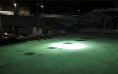
Detecting Oil Under Ice and on the Seafloor
The goal of this project is to develop an integrated system of sensors that could be installed on an underwater platform and used to locate spilled oil that was either: i) trapped under ice or, ii) had sunk to the bottom of the water body.
ExxonMobil Oil Spill Response Knowledge Transfer Webinar Series – June 2022
David Dickins was invited to deliver a one-hour lecture based on his background of over 45 years of research into the behavior of oil in ice. The talk focuses on personal experiences with a series of large-scale field experiments conducted between 1974 and 2009 in...
Appointment to the Science and Technical Committee of the Prince William Sound Oil Spill Recovery Institute
David Dickins was re-appointed in February 2025 to serve a second three-year term on the Science and Technical Committee (STC). Members are specialists in matters relating to oil spill containment and cleanup technology, Arctic and sub-Arctic marine environments,...
After 20 years in San Diego, we moved